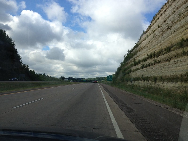
I dread the spring and summer tempests that ravage the Midwest, but I love the clouds of the seasons after the uniform gray of winter.
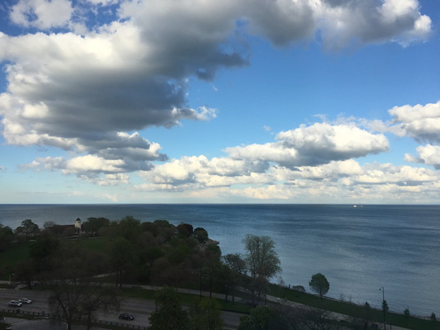
I dread the spring and summer tempests that ravage the Midwest, but I love the clouds of the seasons after the uniform gray of winter.


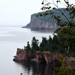
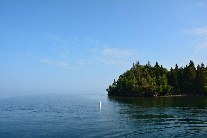
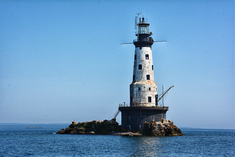
One of my favorite photos from a July 2013 visit to the northern Midwest — the Rock of Ages light near Isle Royale National Park, taken from the boat that ferries visitors to the island.

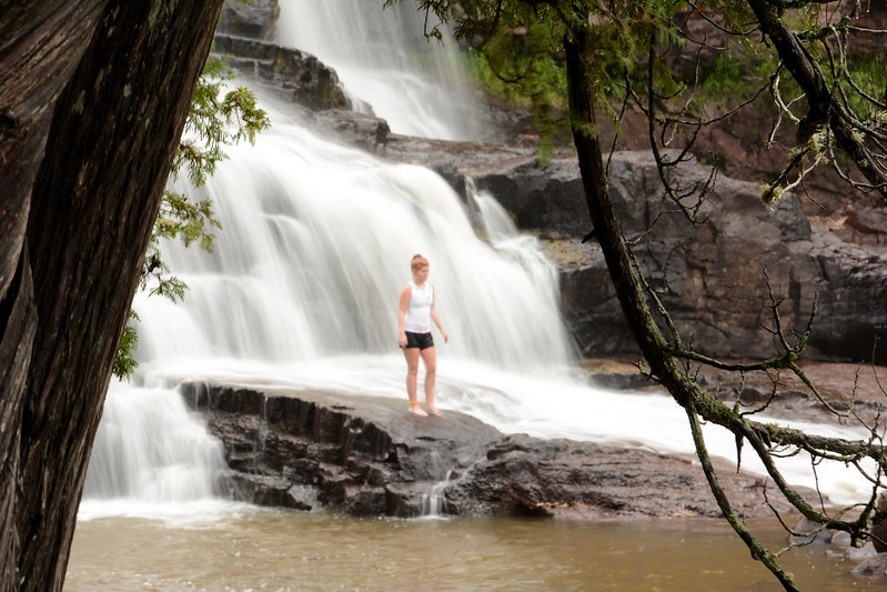
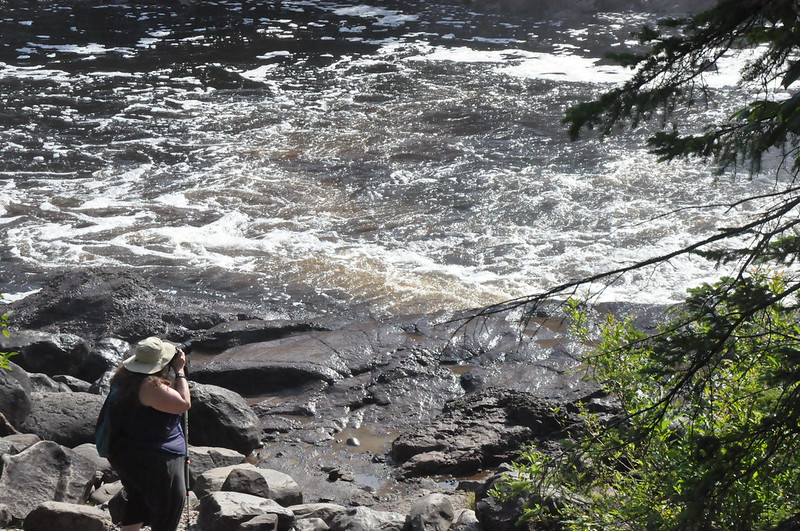
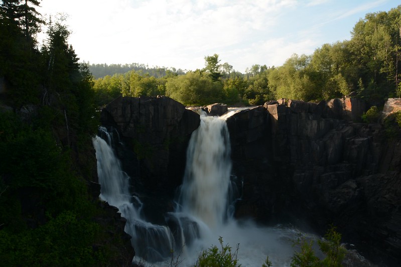
Until I get around to writing about this summer’s visit to Minnesota, here’s a compare and contrast of High Falls in Grand Portage, Minnesota, from one summer to the next — quite a difference in the volume of water.
July 2013:
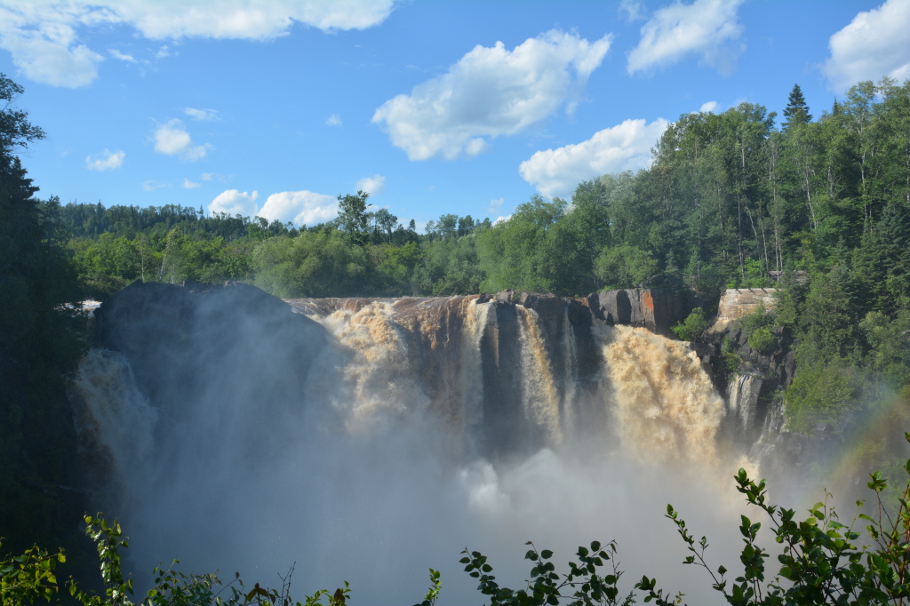
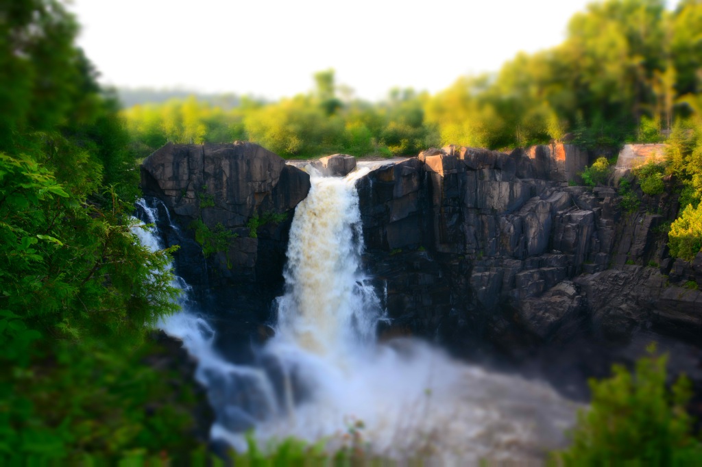
August 2014:

And in miniature for fun:
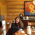
After breakfast at Avalon Hotel and Conference Center, we hit the road. J. had been wanting to stop in Black River Falls, which is named for a dam. After passing vintage train cars we arrived at Molly’s Rude Awakening, then located in a colorful garage, but they were in the midst of a move to a new location. We pulled into a parking space designated for hippies — more for a VW bus than a gray Toyota Corolla. Because of the transition, Molly’s was walk-up/drive-through only, but the ice cream was good.
Now all that was left was another detour to Prairie du Sac and Blue Spoon Café. We arrived at about 1:30 p.m. or so and dragged ourselves away maybe an hour or so later — it was so hard to leave. After a quick drive through town to look for a post office, it was really time to leave.
Thanks to construction at the Wisconsin-Illinois border, progress was very slow before and after the Turtle Creek rest area in South Beloit. It was so slow that we wondered if our new plan would be thwarted — to stop at the Hyde Park Animal Hospital to pick up Petunia a day earlier than planned. Just as it was looking highly unlikely, traffic opened up, and we made it to the hospital by 6:20 p.m. or so, nearly 12 (very) full days after starting out on this long, yet short northern adventure.
Now the trip really was winding down under more gray skies with occasional rain. After taking some photos of the low but wild-looking Baptism River, we left Baptism River Inn and took a brief detour to Palisade Head, hoping for a slightly better view. Lemon Wolf Café isn’t open on Mondays, so we settled for Northern Lights Roadhouse and Pub, where we were seated on an enclosed porch overlooking the lake and the downpour for a relaxed, homely lunch.
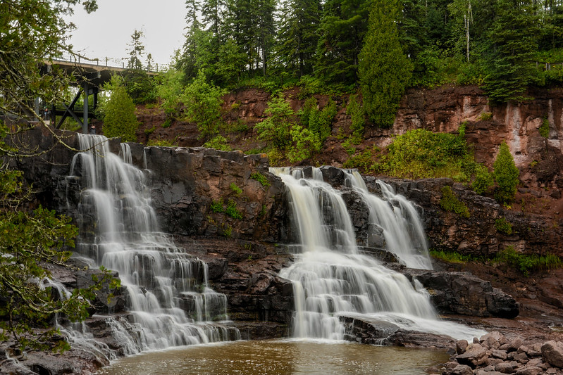
Because of the rain, we thought about skipping Gooseberry Falls State Park, but I knew I’d have have regrets if we drove on by. We, along with many others, waited under the shelter of the visitor center porch as the rain came down, watching drenched visitor after drenched visitor return on the trail.
After a time the rain slowed and stopped, so we took off as fast as we could toward the falls. With the overcast sky, the lighting was poor and the colors washed out, but I continued to work on improving my waterfall photography techniques. We had been there for a while — maybe a half hour? — when we sensed the weather shifting again, so hightailed it back to the visitor center just as the clouds opened up again.
South of Gooseberry Falls State Park we came to the Silver Creek Cliff Tunnel, which was bored through the volcanic rock between 1991 and 1994. We stopped at the wayside to walk along the trail between the tunnel and the lakefront, but after a few feet the rain, which had slowed somewhat, picked up again, and I hurried back to the shelter of the car while J. opted to hang in and get drenched.
Further south, we passed through Two Harbors in search of a coffee shop, but if I remember right the one wanted to go to was closed. Further along we stopped at SuperOne to pick up containers for all our leftovers. At this point, it truly felt like the wilder parts of the Gunflint Trail and North Shore were well behind us — we were back in town.
Too, too soon we were in the city, Duluth, passing what appeared to be ritzy historic mansions, one of them a museum. We said goodbye to Highway 61, which merges into I-35 at 26th Avenue East. It was like a farewell to a beloved friend you may never see again.
It had become sunnier, and Duluth in full daylight is not nearly as eerie as it had been the first time I passed through in July 2013, at twilight on a misty night that made the city and hills appear as ephemeral as Brigadoon.
We pushed on to Superior, Wisconsin, and Red Mug Espresso, a half-underground coffee shop steeped in colorful art for sale and housed in a historic building. Their website cites one of Mike Royko’s favorite ideas:
Sociologist Ray Oldenburg talked about the importance of the “third place” — a community anchor, separate from home and work, where people feel welcome, socialize, and meet friends new and old.
(For Royko, his third place was a bar.)
“It’s a place to live your life,” the site adds. I would if only it were closer. As with so many places I’ve found on journeys both short and long, it was hard to leave this experience behind, but we still had plans for the remaining daylight.
One of these plans, a visit to Superior Entry Lighthouse, was thwarted by a combination of diminishing daylight time and the bumpy nature of Moccasin Mike Road, which isn’t that long. We couldn’t guess at what Wisconsin Point Road would be like on the narrow strip leading to the light, so we agreed to turn back on Moccasin Mike (I just wanted to say that name again) and head for our next out-of-the-way stop, Pattison State Park.
After driving down what seemed like endless country roads, we arrived at Pattison State Park, which is home to Wisconsin’s highest waterfall, Big Manitou Falls. You’d think it’d be easy to find a 165-foot-high waterfall, but it was surprisingly difficult — maybe because we were tired and easily confused by the directions some people we ran into gave us. The first spot we found seemed to be above the falls and didn’t offer a view. J. went one way while I went another. My way led to a platform on a cliff side overlooking the falls. To my left below, the falls roared. To my right, the sun was headed toward the horizon in a show of bright clouds and dark hills. The view on both sides helped make up for missing Superior Entry. Alas, we missed Little Manitou Falls, which are a few miles upstream.
With the sun setting, it was time to move on and get as far south in Wisconsin as we could. We made it — with effort — to Chippewa Falls, where we stopped at a chain hotel with no rooms. The very helpful desk attendant called two other chains — also no vacancies. She told me that’s not unusual for Chippewa Falls, which is a hotbed of business. The last place she called is, like the Bates Motel, somewhat off the major road. For that reason perhaps, they had available rooms. Avalon Hotel and Conference Center is a hybrid hotel-motel; many rooms have both inside rooms like a hotel and outside doors like a motel. Nervous guests can get a room with an inside door only. After a long day and the experience of last year, all that mattered to me was being able to crawl into a comfortable bed before the wee hours arrived and getting rested for the long day ahead.
After breakfast courtesy of our hostess, we crossed the scary, narrow bridge toward the outside world and headed north to Cascade River State Park. On the way, we detoured at Lutsen, where Moondance Coffee House called. How can anyone go to a chain coffee shop when there are gems like Moondance in this world? (Okay, it’s a bit far for the average person.)
The cascades of the Cascade River are an easy, relatively short walk from the parking area (short if you don’t photograph every scrap of the fungus along the way). There are three cascades we could see. I watched some hardier people go up a trail that runs along the river, and we followed them partway. As with everywhere else in northern Minnesota, I’m sure we scratched only the surface of Cascade River State Park. This visit was a little bittersweet because this was the last time we’d visit one of the more northern parks on Highway 61.
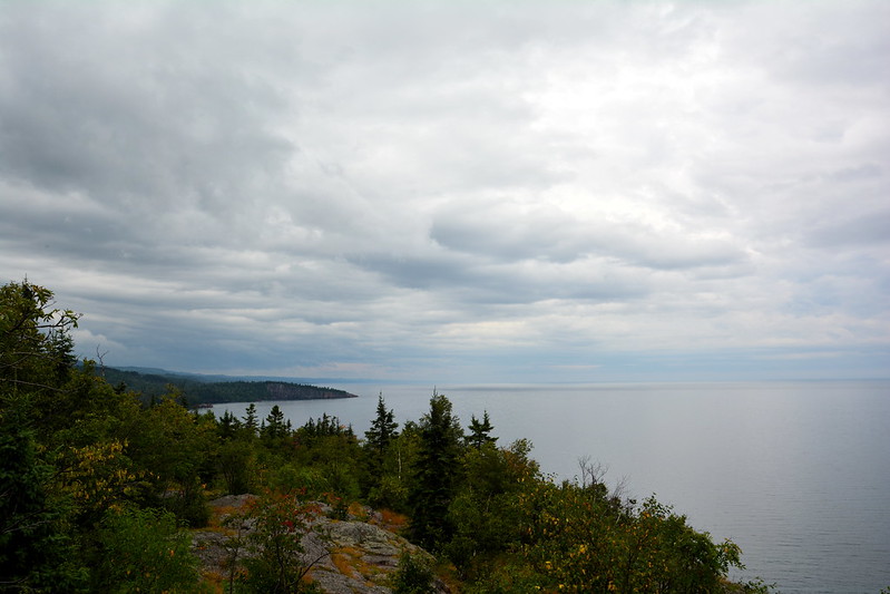
By the time we arrived at the impressive Tettegouche State Park visitor center, the weather had turned cloudy and threatening. After spending some time shopping and relaxing at the visitor center, we decided to try to make it to Shovel Point, which is one of those “must see” places. By now, however, I was miserably fatigued and couldn’t get very far, the sky was dreary and uninteresting, and it was spitting enough rain every now and then to be a little uncomfortable without rain gear handy, so I didn’t get far and J. didn’t get much farther. We did get some okay photos, and we drove to Palisade Head for a panoramic if gray view of Lake Superior. I remembered Palisade Head from last year, to my surprise, because of the steep, twisty, narrow, partly one-lane drive up. It felt like returning to an old friend.
Our final stop before returning to Baptism River Inn was another old friend, Lemon Wolf Café in Beaver Bay. It seemed less crowded than last year, but the soup with wild rice was delicious, and so was everything else we ate — once again undoubtedly undoing any health benefits we would have gained from the day’s walking.
The sky was opaque with clouds, so now we were fairly certain we’d see no aurora borealis on this trip. I’d stand out in a downpour for that . . .
After some confusion about the length of stay at Shoreline Inn (J. thought it was two days), we relaxed on a deck overlooking the beach until the sun became too much, then set out for the next destination, with a brief detour to the Grand Marais Pharmacy — a traditional pharmacy housed in a log-style building.
Our destination was Judge C. R. Magney State Park, which we had missed last year and which I later discovered is home to a not-to-be-missed attraction — Devil’s Kettle. More than an attractive waterfall, Devil’s Kettle is where half of the Brule River, split by a rock formation, flows merrily on its obvious course to Lake Superior. On the other side of the rock, half of the Brule pours into the “kettle,” where it disappears forever, at least in the imagination. No one knows for sure where it reconnects with the Brule, if it does, or if it flows underground somehow to Superior. According to geologist John C. Green:
One [theory] is that, after dropping down the pothole, the river runs along a fault underground, or as a variant, that it enters an underground channel and comes out somewhere under Lake Superior. Both of these ideas have one valid aspect in common: they recognize that water must move downhill.
But the main problem is creating a channel or conduit large enough to conduct the impressive flow of half the Brule River! Faulting commonly has the effect of crushing and fracturing the rock along the fault plane. This could certainly increase the permeability of the rock — its capacity to transmit water — but the connected open spaces needed to drain half the river would be essentially impossible, especially for such a distance.
Furthermore, there is no geologic evidence for such a fault at the Devil’s Kettle. Large, continuous openings generally do not occur in rocks, except for caves in limestoneterranes. The nearest limestone is probably in southeastern Minnesota, so that doesn’t help… Maybe the Devil’s Kettle bottoms out fortuitously in a great lava tube that conducts the water to the Lake… Unfortunately for this idea, they are not the right kind of volcanic rocks.
Rhyolites, such as the great flow at this locality, never form lava tubes, which only develop in fluid basaltic lava. Even the basalts in this area may not be the “right kind”, being flood basalts that spread laterally as a sheet from fissures, not down the slopes of a volcano. No lava tubes have been found in the hundreds of basalt flows exposed along the North Shore.
Furthermore, the nearest basalt is so far below the river bed, and even if it did contain an empty lava tube (very unlikely after its long history of deep burial) the tube would have to be both oriented in the right direction (south) and blocked above this site so that it isn’t already full of debris. And there are no reports of trees or other floating debris suddenly appearing at one spot offshore in Lake Superior. The mystery persists.
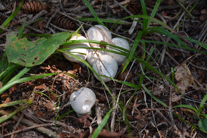
How could I miss such an opportunity? This was a longer walk, my energy levels were subsiding, but we had read that there were a few strategically placed benches along the way. And I was highly motivated to push myself. We found the parking area and the signs and launched ourselves down the trail, crossing the Brule. J. quickly became sidetracked by the multitude of mushrooms in the park, so I went ahead. This is a well-marked, well-traveled path, but Judge C. R. Magney is largely untamed, and most of it is inaccessible. As this was the day’s only planned activity, I felt less pressured to hurry. Along the way, I came upon an overlook with a bench and a view of some waterfalls. Also on the way we stopped at a place where you can walk out on to the rocks by the river — a wild spot.
Later J. caught up with me, and we found there are a lot of stairs down (which means a lot of stairs up on the return). Further along, after we’d gotten separated again, I came to another set of steps and fell up the first high one, which made me even weaker with laughing in front of a couple who was sitting there. Half was the humor of how silly I must have looked; the other half was relief I didn’t crack my kneecap.
I wasn’t sure I was going to make it but I did reach Devil’s Kettle — keeping the promise to myself to see it was well worth discomfort on the way. We spent some time at one overlook, then moved on to a slightly lower one, all the while taking photos. Like the other waterfalls we’d seen this year, Devil’s Kettle was running lighter than it sometimes does — I’ve found a video in which a torrent surges over the rhyolite rock obstruction, almost obscuring the split in the Brule. Wherever the kettle half of the water goes, it must be able to accommodate a prodigious volume.
On the way out of the park we disturbed a groundhog, who ran to a drain for cover — and found himself trapped. I took photos and videos as he looked around, trying to figure a way out, but we soon left him in peace.
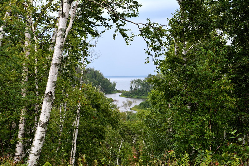
We stopped at the spot where the Kadunce River flows into Lake Superior, which again was calm. It’s fascinating to think about all that water winding its way for several miles through the woods, only to disperse itself into the breadth and depth of an inland sea, from where it will touch who-knows-how-many people. I looked upstream, which looks like it would be a beautiful walk. I’ve read since that from this spot you can walk over six Kadunce waterfalls in about a mile or so when the water is running low. I wish I had known that sooner — I might have planned a morning or afternoon around it.
Our next stop was at the Dairy Queen in Grand Marais, where we undid any health benefits we’d gotten from walking over the slightly uneven terrain and the steps down and up at Judge C. R. Magney State Park.
We headed south on 61 with few specific plans for the next couple of days and with a sense that our vacation was quickly coming to an end. We found the area we were looking for easily enough, but pulled up at a house that didn’t look like our destination. No doubt used to bewildered tourists, a woman came out and told us how to get to Baptism River Inn — we’d missed the turnoff in the dark, which isn’t surprising. It’s reached over a low, narrow bridge with minimalist if any guardrails. We arrived a little before 10 p.m., to find that hosts and guests were tucked in for the night — good idea.

We arrived bright and early for the boat trip to Isle Royale National Park and to our delight were called very early in the boarding process — we could get our choice of seats. The weather was warmer and sunnier than last year, so we didn’t notice the cold in the stern area. Being by now seasoned veterans of one previous trip, we knew where to look for the “witch tree,” the wreck of the America, and the Rock of Ages light (best photographed on the return trip, when the pilot navigates around the light slowly). The trip seemed shorter, maybe because we knew how long it would take and we weren’t shivering the whole way.
At Windigo, once again we spent time at the store and visitor center, but this time the flocks of butterflies around the shrubs near the dock were gone. I had been hoping to get some better photos of them this year. We met a guy who’d walked from the other end of the island, but it sounded like he hadn’t run into a moose on his week-long journey.
We headed for the campground, where we wandered around and checked out the primitive campsites (three-sided shelters with an opening of netting — very cozy). On the way, we passed some odd structures on slight hillside. According to the sign, they’re part of the park’s minimally invasive sewage system. I thought about the guy we’d just met and wondered if he was going to try out the short, expensive showers at Windigo’s nearby bathroom (several dollars for a few minutes).
J. found where a previous camper had left his mark, “Moose is a myth.” We didn’t see much wildlife, maybe because it was a few weeks later in the summer. I found only the remains of what may have been a rabbit, strangely unconsumed. On the way back, we passed mergansers sunning themselves on a rock.
At the dock, again we were called early in the boarding, so this time J. didn’t have to stand on the starboard side getting drenched with cold spray. We were in a good spot to get photos of the Rock of Ages light, which was perfectly illuminated in the afternoon sun.
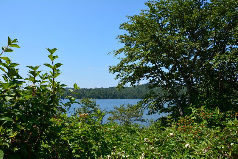
After returning we had some time, so we went to the Grand Portage National Monument visitor center. The general area was mobbed as there was some kind of reenactment going on. The Monument overlooks Grand Portage Bay and Grand Portage Island, formerly known as Isle au Mouton and Pete’s Island. It’s a beautiful view in the late afternoon sun.
Our next stop was at Grand Marais and Shoreline Inn. Every herring gull along the North Shore seems to lurk among the buildings in Grand Marais, maybe because that’s where the tourists, and the tidbits that come with them, are. Perched along most of roof lines in sight, they cried and cried and cried during the evening, most likely settling down later so they could start up again in the morning.
Back near the Gunflint Trail, J. told me a co-worker had recommended the Gunflint Tavern, which was very busy. Halfway through dinner, though, I felt sick and woozy (unrelated to dinner), so left J. and walked back to Shoreline Inn, still guarded by gulls on the roof. The evening air helped, and the night view of the shore and the lake was lovely, a peaceful end to a full and filling day.
After breakfast I watched a couple pack a canoe and marveled at how much they managed to get into it. Clearly they were going a lot farther than the palisades. Finally they set out, with the female person in the back, although they didn’t get far. They must have decided to head back and switch places, but before they did that, the canoe started to spin. And spin. And spin. Just like an amusement park ride. Kevlar must be great for portages and for nausea. I wondered how experienced they were.
Reluctantly we left Clearwater Historic Lodge with the idea of seeing a wildflower sanctuary J. had found on a list of attractions. Naturally, we had difficulty finding it, and were almost in Grand Marais before discovering we needed to backtrack, not to mention find facilities. A few miles off the Gunflint Trail, we discovered Devil Track General Store, with essentials scattered on half-bare shelves. I felt like I had stepped many years and many miles back in time, to a place like Mayberry after the interstate had bypassed it and it had been forgotten by the strange inhabitants of the stranger steel and glass towers that have creeped over more of the landscape of the modern world. Cue the Twilight Zone music.
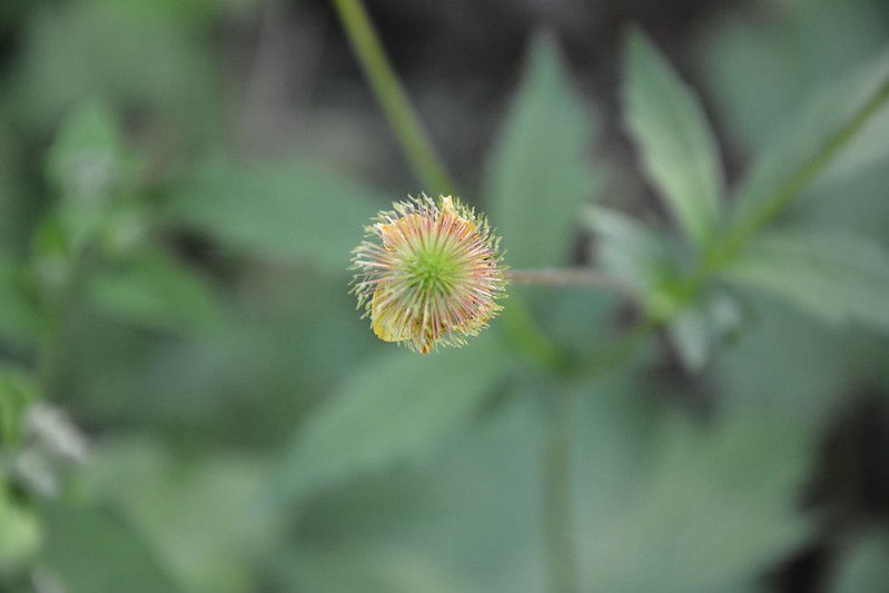
We did find the Devil Track Wildflower Sanctuary, which is along the relatively short Devil Track River. The trail is grown over and close, and for some reason I opted not to go very far down it. Instead, I spent a good hour or so photographing flowers around the gravel parking area, where they grew abundantly. During this trip, I think I spent as much time photographing flowers as I did waterfalls, rivers, and lakes.
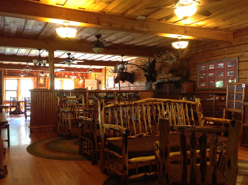
Next we set out for Grand Marais, where the marvelous Java Moose café awaited with good coffee, ice cream, WiFi, and a lovely view of Lake Superior. This is yet another place where I could have stayed forever, people and shore watching. Alas, after an hour or so, it was time to move on to our luncheon destination — Naniboujou Lodge and Restaurant, built in the 1920s as a club with a giant rock fireplace. There had been no room at the inn, so the plan was to have lunch there. At this time of day the dining room was sparsely populated, although a group did appear. Afterward, while J. perused the gift shop, I went behind the lodge and took photos of a particularly serene Lake Superior.
There had been room at Grand Portage Lodge and Casino, so that was our next destination. Last year, we’d driven there late at night in driving, blinding rain. Now it was a sunny late afternoon, perfect weather for a relaxing drive along a road that had seemed more terrifying a year earlier in the darkness and rain.
After checking in, we went to Grand Portage State Park, home to Minnesota’s highest waterfall (imaginatively named High Falls). The park belongs to the Grand Portage Band of Lake Superior Chippewa, and they lease it back for a nominal fee so all of us can enjoy this marvel. Last year High Falls had been such a torrent that even on the steps to the platform we were soaked by the spray and deafened by the roar. In comparison this evening’s High Falls was a mere trickle, with no spray and more of the underlying rock exposed. I noticed the lack of spray, but didn’t think much of it until I compared my 2013 and 2014 photos. Then I realized Cross River had also been running much more lightly this year than last, when it had been almost terrifyingly high as it rushed toward Highway 61.
After a couple of stops to admire Lake Superior, we returned to the Lodge and finally made it into the pool that we’d missed out on last year. Ahhh. Tomorrow was going to be an early morning.