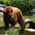
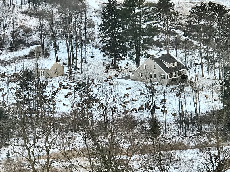
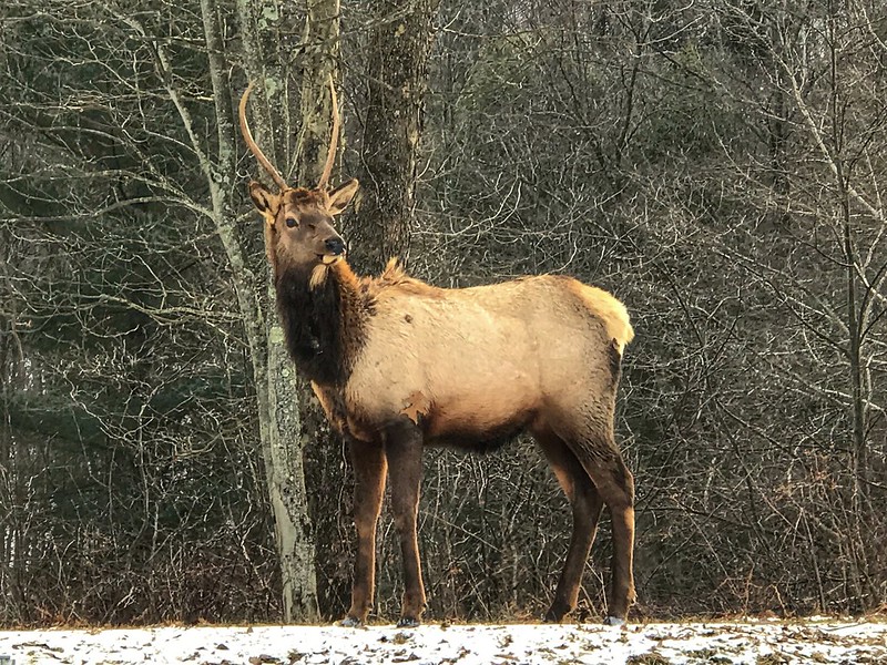
December 27, 2017: Visiting part of the Pennsylvania elk herd in Benezette.


 dreamer
  thinker aspirant


December 27, 2017: Visiting part of the Pennsylvania elk herd in Benezette.
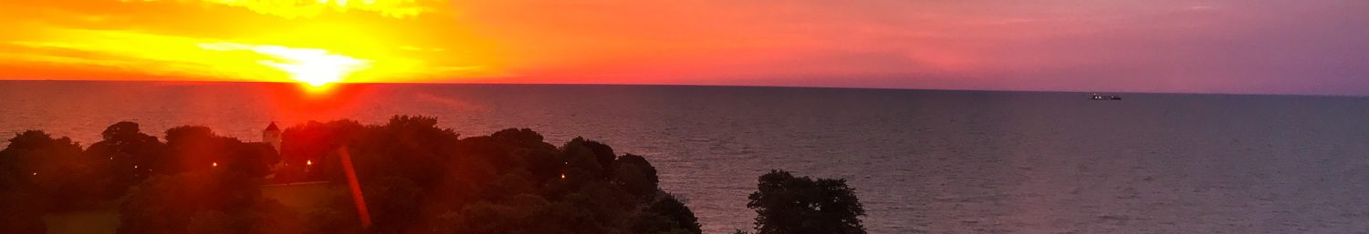
Sunday, December 3, in Chesterton, Indiana.
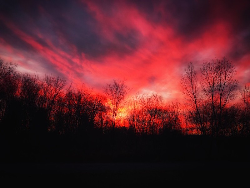
The sun may hide for most of a northern winter, but winter sunsets can be spectacular. Saturday, December 2, after the Chesterton Mistletoe Market and a detour to Rise & Roll Bakery in Valparaiso.
My family didn’t travel for recreation. When we visited relatives, we stayed with one of my dad’s sisters, Mildred or Thelma. Even when I figured out that other families went on real vacations to Disney (ugh) or other attractions, I never thought about where they hung their hats at night.
Psycho, of all things, exposed me to that all-American icon, the motel or motor inn, with its outside doors and convenient parking. By 1960, though, even the Bates Motel had become a victim of the burgeoning interstate system, accessible only to those few who happened to stray onto the exit, say, during a blinding downpour.
Judging from the mid-century motels that remain open, someone still stays at them. I’ve spotted a few on the north side of Chicago as well as in a number of small midwestern towns. I can tell they’re old school because they tout amenities like air conditioning and color TV. Not just TV, but color TV. If today’s signs weren’t programmable, future generations might wonder at the “free WiFi” advertised at interstate exit hotels.
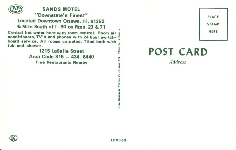
Years ago I spotted this old-school sign in Ottawa, Illinois, where “Lincoln’s voice was FIRST heard!” and a number of women worked themselves to death painting radium onto watch dials. Ever since I’ve wanted to stay there so I could take photos of the sign and enjoy some of that good old-fashioned air conditioning and TV (color not mentioned, but assumed). When I looked the Sands Motel up, I found the rate — under $50 — also looks like a relic from yesteryear, perhaps the 1980s. (Ice, however, is extra.)

Arriving at The Sands from long drive from Flossmoor, I didn’t think to look at the sign. After hiking at Matthiessen State Park and dining at the Lone Buffalo, I was too tired to look at the sign, although I had passed it at least three times by then. The fact that I didn’t notice the sign should have been a clue that something was up. Yes, imagine my surprise when the next morning I went out to take a photo of the beloved sign and discovered this:
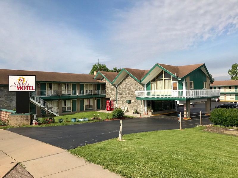
The sign had been replaced! I sent my friend to the Sands Motel office to get the story, which varied a bit from a local newspaper account that’s no longer online. The sign was not the victim of changing fashions or tastes but of its own age and years of exposure to Illinois weather. It had become a hazard, perhaps ready to topple in the wind. If you look beyond the rust, you can see a crack between the bottom and middle pieces. The new, less elaborate sign perhaps plays a sly tribute to its predecessor’s fate, depicting a tilted hourglass with the sands of time starting to run out.
What’s that you say? “What’s an hourglass?”
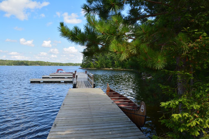
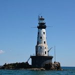
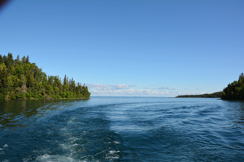
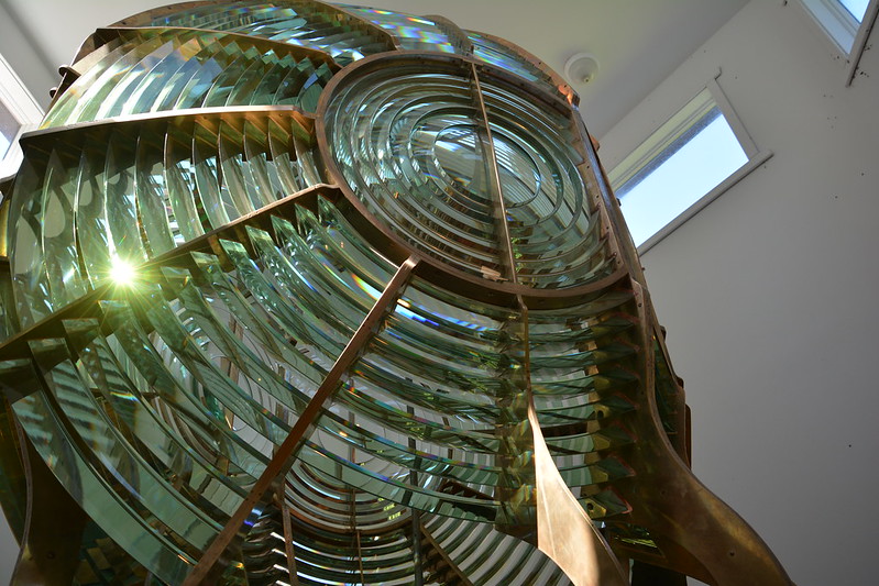
One of my favorite photos from a July 2013 visit to the northern Midwest — the Rock of Ages light near Isle Royale National Park, taken from the boat that ferries visitors to the island.

Our first stop in the morning was at Chocolate Moose (one of the few moose we spotted during the trip) for breakfast en plein air. Next, we were lured in by their neighbor, Piragis Outfitters, where we found cool stuff like bags and sporks. Who wouldn’t love a good Swedish-designed spork? I’m almost as dangerous at an outfitters as I am at a bookstore or office supply shop. If I camped or canoed or kayaked, I’d be destitute.
The next stop in Ely was the North American Bear Center, where we arrived in time to see the enrichment program at work and some of the relationships between the bears in play. I supplemented my Vince Shute photos with some of the center’s youngest bear treed by its largest, and of the largest bear snarling. She didn’t seem to be in a good mood on this beautiful August morning.
Toward the end of our visit, we ran into a woman who encouraged us to drive around Shagwa Lake, which is one of the many places I’d hang out at if I lived in Ely. Judging from the family we saw on its shores, it’s as good for wading and fishing as it is for photography.
J. stopped briefly at the Dorothy Molter Museum, a tribute to the “Root Beer Lady.” She’s said to be the last non-indigenous resident of the Boundary Waters Canoe Area Wilderness (BWCAW). Her homestead was dismantled in 1987, with two cabins restored in Ely. She made root beer and sold it to canoeists. I confess that at the time I didn’t find this as interesting as J. did, so I stayed in the car. I’m still haunted by all the stops made during last year’s trip, the long drives between destinations, and the resulting 1 or 2 a.m. arrivals. I have to get over that.
At the International Wolf Center, a lone wolf posed for photos, although I wasn’t quick enough to get a photo of him while he was moving.
Both the bear and the wolf centers offer a great experience, with lots of information for the interested adult and activities for children. While resting my feet at the Bear Center, I watched videos of Alaskan brown bears catching salmon and strutting off with their victims. I also posed with a late member of the elusive moose species and compared my size to the that of several North American bear species (at best, I’m the height of a juvenile or female black bear). At the Wolf Center, we walked through an exhibit of aurora borealis photos — the northern lights that in nearly three weeks of travel in 2013 and 2014 we were destined not to see even once.
After all this activity, we went to a café I’d found on Yelp!, the Front Porch, which is as comfortable as a café can get. It’s in a house with a lot of porch space in addition to roomy interiors. The food and coffee were good, and so was the cheesecake we bought for later. The Front Porch ranks high on my list of places I didn’t want to leave and that I wish were nearby. That’s even without having seen the live music offerings they have on some evenings.
After tearing ourselves away from the Front Porch, we began our hunt for the Ely pillow rock, which I’d spotted on a whimsical tourist map of Ely I’d picked up at Fortune Bay. From waymarking.com:
This historic 15’ rock outcrop is a wonderful example of Ely greenstone, a “rare ellipsoidal lava flow formed beneath primeval seas 2.7 billion years ago.” It is volcanic in origin and there are very few specimens like this in the world. It is easily accessible 24/7 and can be seen on the north side of Main Street in the northeast part of town.
Ellipsoidal lava is also known as “pillow laval” [sic] and is any lava characterized by pillow structure and presumed to have formed in a subaqueous environment.
When you have a chance to see a 2.7 billion-year-old lava rock in the Midwest, you can’t miss it. We almost did, however, because it was hard to find. A pair of cyclists tried to help, but I’m not sure they agreed on where to send us. After we drove around a while and ended up downtown again, one of my map apps finally gave me a clearer picture of where it should be on Main Street, which, despite its name, proved to be a gravel road.
When we finally got to what looked like the right spot, we didn’t see it at first because it was down the road a bit. This ancient piece of lava, formed when the area was underwater, is on the edge of a wooded area across from some typical houses. Most likely the residents who see it every day are over its charms, but I would find it amazing to pass such a relic of the past every day. I would feel more connected to the world that was than to the world that is.
During all this driving through Ely, we’d seen a custard place, Red Cabin Custard. It was a warm enough day for it, and stopping there gave J. a chance to get a Dorothy Molter root beer, while I had a PMS sundae (I recommend it whether you need it or not).
After packing up and checking out of Silver Rapids Lodge prematurely, we stopped at Kawishiwi Falls, which is a relatively easy short walk. The falls seem to be downstream from a dam, but that didn’t detract from their beauty in the early evening.
Leaving Ely behind, we set out at last on Highway 1, which was a long, lonely drive that seems to be used primarily by mining and logging vehicles. We saw very few cars, a few trucks, and no moose, although there may have been a white-tail or two. Even the towns seemed tiny and remote.
At least we reached Highway 61, the scenic road that runs along the western shore of Lake Superior. To our surprise, Highway 61 was under construction. Whether it was northern Illinois, southern Wisconsin, the Sauk City area, or now Highway 61, we couldn’t get away from construction. In this case, long stretches were gravel only, and some parts were down to one lane with long red lights to control traffic. Gone is my original memory of 61 as a misty, lightly traveled wonder (which it still is, in parts).
After bumping along for miles of torn-up, gravelly road, we arrived at the Americinn in Tofte, perhaps another sign of a growing tourist trade along the North Shore, to get ready for the next day.
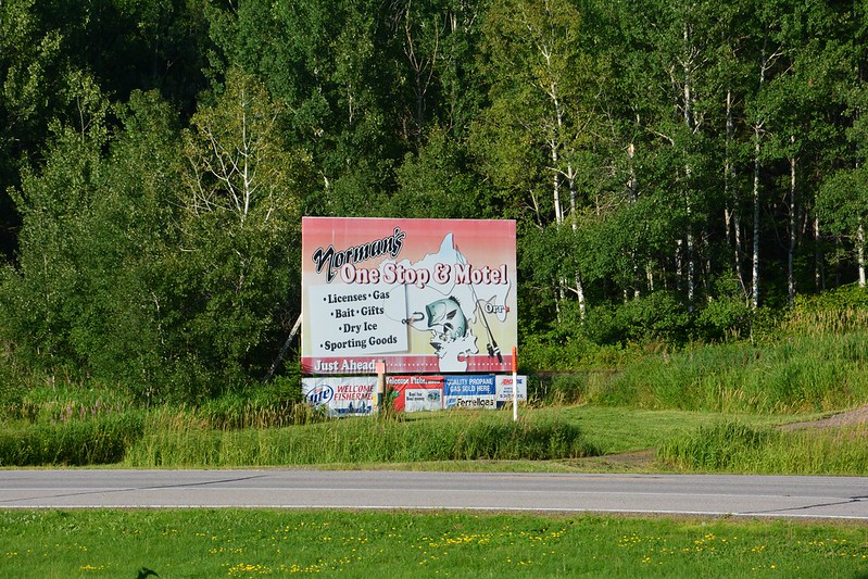
August 3 began as a leisurely day — a little time in the whirlpool, then quality time at Tim Horton’s, located within Fortune Bay. I’d never had the chance to go to a Tim Horton’s, although as a young Buffalo Sabres fan I knew his story. After sipping the famous coffee, stocking up on doughnuts and Timbits, and raiding the hotel gift shop (unusual for me), we set out for the Ash River Visitor Center, part of Voyageurs National Park. Along the way we stopped at a tiny, picturesque gas station and convenience store that was fun to browse, especially for some interesting maps.
Ash River Visitor Center, or Meadwood Lodge, turned out to be a beautiful log building constructed by Finnish carpenters, according to male half of the couple who runs the center. I envy them their jobs in a great location overlooking the water. If I could go back in time, that might be me. They were friendlier than I am, however. With a glance at our Nikons, he told us we should enter the Voyageurs photo contest that was soon ending. (Alas, we never got around to it.)
We took advantage of the center’s picnic table to eat some of our leftovers from Blue Spoon Creamery Café while enjoying the serenity of the intense greens, blues, and white of the trees, water, sky, and clouds. I know winters at Voyageurs are harsh and bitter cold, but this painfully brief summer moment made me wish I live nearby. Fortunately, I was reminded that I hadn’t died and ascended to the heavens by the painful bites of the omnipresent flies and mosquitoes.
We explored some of the short trails along the road from Ash River, running into a man whose children, led by one determined girl, were on a quest for berries. So far, he said, they hadn’t found the mother lode the ranger had told them about, and the girl pointedly showed me her nearly empty container.
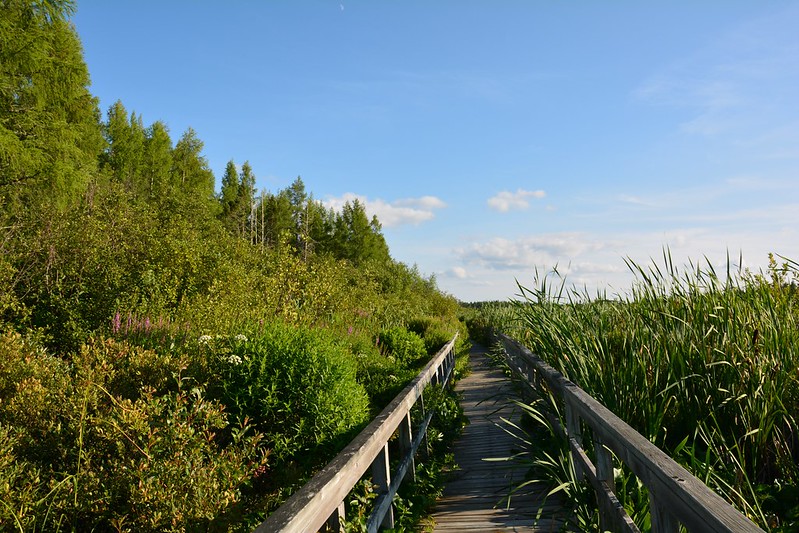
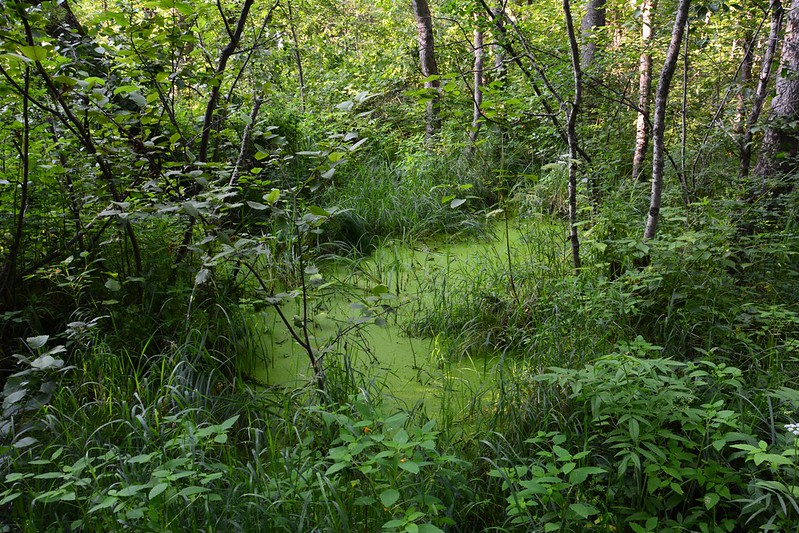
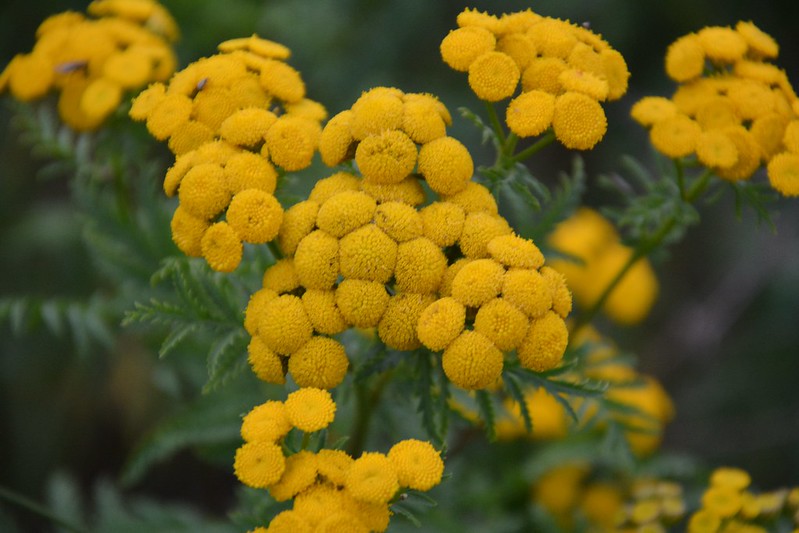
With the perfect weather and the beautiful views, we stayed longer than planned and got back to Orr as the sun was heading toward the low end of the downward swing. Here we braved the mosquitoes along the Orr Bog Walk, which is a botanist’s dream. I took photo after photo of flower after flower while being eaten piece by piece by the ubiquitous mosquitoes. It was an easy, uncrowded walk, with lots of visual rewards along the way. I did miss getting a photo of a sapphire blue dragonfly, and the dull green guy that appeared afterward was no substitute.
This night’s stop was at a Silver Rapids Lodge, which, despite its great location, needs an overhaul of its 1950s trappings. It’s a little too retro.
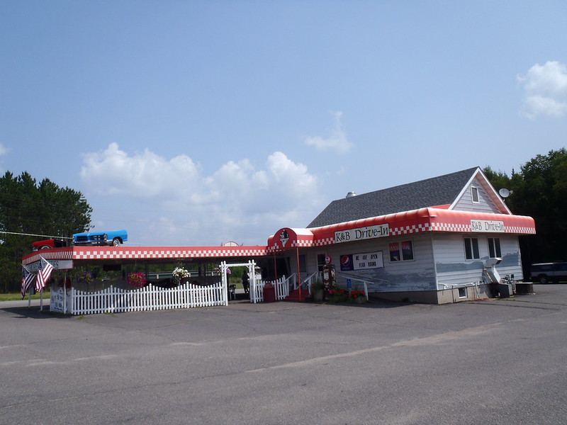
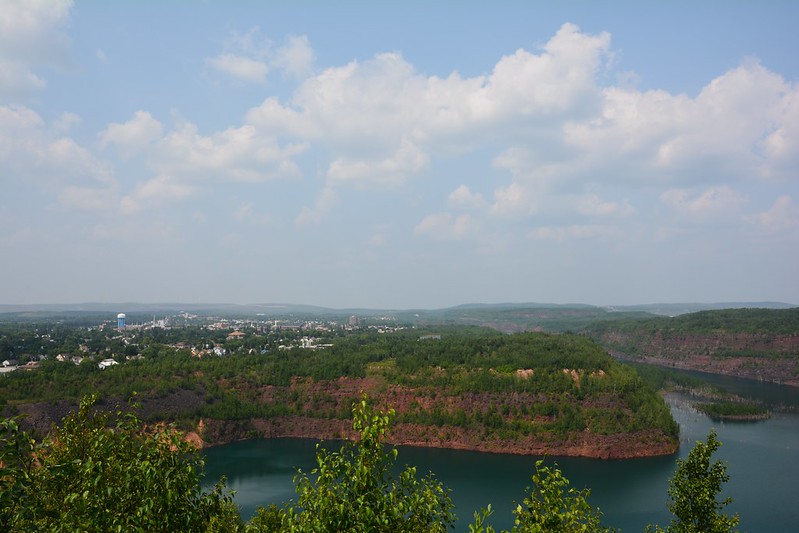
Having missed the K&B Drive-In the night before, we returned to Eveleth so J. could get his BBQ fix. We’d passed a place called Mineview in the Sky, which seemed to be uphill, so I assumed there might be a view. There was — of the junction of three former taconite mines. You know you’re in the Iron Range when you see signs like, “We support mining. Mining supports us.” I can only wonder what this area looked like 500 years ago, when mining wasn’t around to support anyone in the Iron Range.
After Mineview (and King of the Lode), we stopped at the Eveleth Harley dealer so J. could check out souvenirs for his Harley-loving brother, passing (but not stopping at) the U. S. Hockey Hall of Fame.
After the luxury and comfort of the Harley dealership (these seem to cater to affluent, middle-aged road warriors), we found the coffee shop in Virginia that I was looking for, the Shop Coffeehouse. Friendly folks, colorfully arty décor, comfortable seating, good WiFi. No TV, and I don’t remember intrusive music. I could go to a place like this within walking distance of the Flamingo. And I could have stayed here all day. Vince Shute Wildlife Sanctuary, however, beckoned.
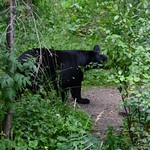
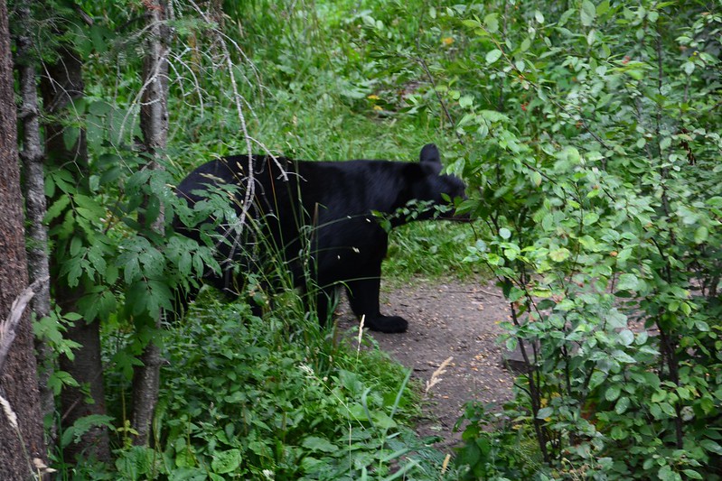
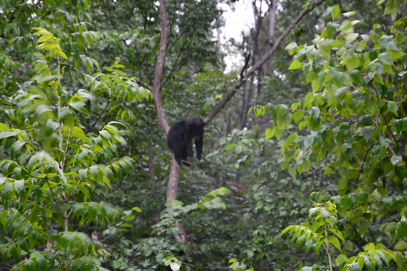
As we headed toward Vince Shute, the previously pleasant but somewhat hazy day started to turn cloudy. We had arrived at the sanctuary, boarded a bus, taken a ride to the observation area with a student guide, and seen some of the bears chowing down when the rain came. The bears cared not one whit. J., who must have been a Boy Scout, produced the ponchos he’d mentioned earlier, although even with a poncho it’s hard to stay comfortable in that kind of downpour.
With the rain coming down, the mosquitoes that soon set me in their sights were a bonus. The bears, intent on din dins, didn’t mind them, either. As long as we were there, they remained focused on their food, although a couple of adults did indulge in some growling. The one exception was a comical pair of youngsters hanging out in a tree, who posed for me.
We didn’t stay as long as we might have, especially as the cameras were also getting drenched. Soon after we were dropped off at the parking lot, of course, the rain stopped.
We had noticed a bucket placed next to every tire of each vehicle parked in the observation area, so before we left Vince Shute, I had to ask — why? The visitor parking lot attendant told us that bears are attracted to tires and will chew and/or shred them. The buckets contain bear poop, which deters them. I”m surprised the bears haven’t figured out they’re being hoodwinked.
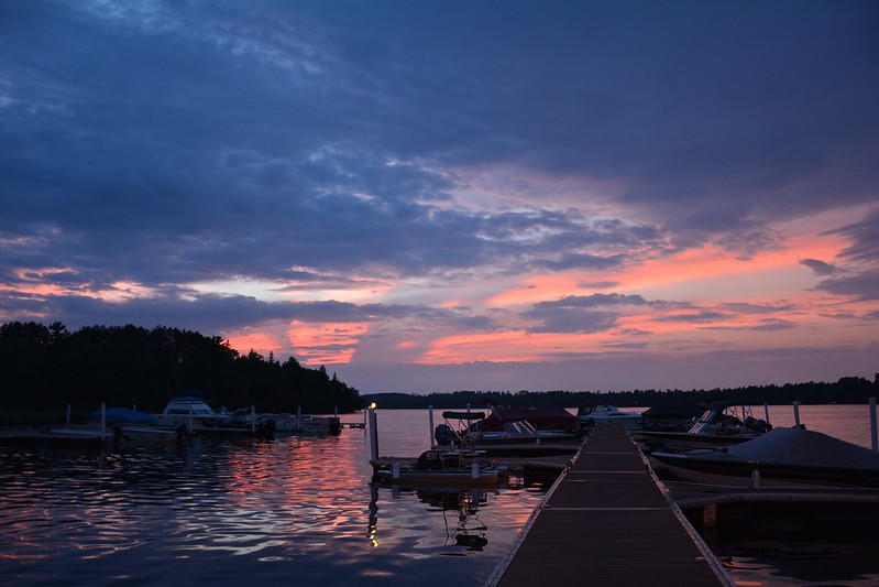
At this point, the sun returned in time to set in all its pink glory over a lake we stopped at on the way back to Fortune Bay and over Lake Vermilion, which earned its name on this serene if damp evening.
The sequel to last summer’s Lake Superior trip began July 31, when J. helped me take Petunia to the Hyde Park Animal Hospital, followed by a quick dinner at Plein Air Café. Finally, we stowed all my stuff in the car and set out, with the goal of reaching Cedarberry Inn in Sauk City.
This isn’t as easy as you’d think. This summer, as last, the Jane Addams Expressway is under construction, which meant for J. driving at night at reduced speed through dozens of miles of construction barrels and barriers. Although I wasn’t driving, I could sense how stressful it was, with no end in sight. I don’t know how people commute through this nightmare every day. Of course, we’d be taking the same route back — something to look forward to! After reaching Wisconsin, we ran into pockets of construction. Even after leaving I90/94 for Sauk City, we faced construction. At least when we got to Minnesota, off the interstates, we thought, we’d face no more construction mazes.
Finally, we arrived at Cedarberry, where the next morning you bet I immersed myself in the warm jets of the whirlpool. So far I had not felt the sharp pangs caused by sitting confined in a car for long periods.
The reason for driving out of the way to Sauk City was to visit Blue Spoon Café in Prairie du Sac. Started by the Culver family of “Butter Burger” fame, Blue Spoon is nestled between one of Prairie du Sac’s main streets and the Wisconsin River. Sitting on the patio overlooking disused, abruptly ending train tracks and the river, I felt relaxed and peaceful in a way I’m not sure that I ever have. Only the need to press on and get to Tower, Minnesota, at a reasonable hour weighed on me.
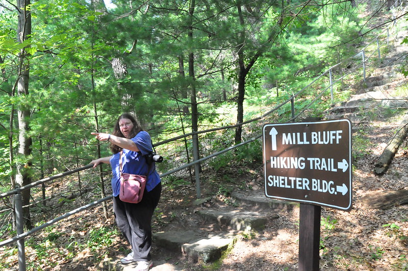
J. noted some state parks along the way that he thought would make great stops, but I’m doomed to be the nay-saying killjoy. When we spotted a series of stone stacks along I90/94, however, I agreed this was worth investigating, however briefly. This proved to be Mill Bluff State Park, and the bluffs are what you might call sea stacks, formed underwater. Mill Bluff State Park is part of the Ice Age National Scientific Reserve in the Driftless Area.
Even though this park is in the driftless area, the area the glaciers missed, the geologic features are partially the result of the last (or Wisconsin) stage of glaciation. During this glacial advance, the Wisconsin River was plugged near Wisconsin Dells. The river spread out to form glacial Lake Wisconsin, covering most of what today are Adams, Juneau and other adjacent counties, including the Mill Bluff area. During this time, some of the mesa and buttes stood as islands in the glacial lake, while others were submerged. Wave action hastened erosion of the sides of the rock forms.
The unique flat-topped, cliff-sided rock structures are capped by layers of somewhat more resistant sandstone; and weathering tends to break the rock off in vertical fragments. There are remnants of the Dresbach Group, Upper Cambrian sandstone. The heights of the bluffs range from 80 feet to over 200 feet. The mesa and buttes are isolated “outliers” of the continuous limestone-capped escarpments south of the park.
We drove around a bit, talked to an elderly staffer, drove some more, then found the trail that lead to the top of Mill Bluff, up about 223 steps crafted by the CCC during the 1930s. We have a lot to thank the CCC for, 70-plus years later.
I wish I’d known more about the geology of the area as I stood on top of Mill Bluff, but even to the ignorant like me, the view is spectacular. It takes a little imagination to see the park without I90/94 dividing it.
After Mill Bluff State Park, we did have one scheduled stop — Amnicon Falls State Park, not far from Duluth. After a brief detour down a residential gravel road, we found the park we’d been to before at about the same time of day but two weeks later in the summer, with earlier nightfall. A staffer told J. about a photo contest and to look for Snake Pit Falls near the park’s namesake falls.
Amnicon Falls is indeed a photogenic spot, complete with rustic footbridge. The view of Snake Pit Falls in the growing gloom was a delightful bonus, although I’m resigned to never seeing this park in sunlight or even daylight.
The original plan had been to stop at K&B Café and BBQ in Eveleth, Minnesota, at the recommendation of J.’s co-worker. By the time we hit Eveleth, however, it was past closing time. We did stop at a rest area, where we learned about the Laurentian Divide. How did teachers make earth science sound so dull?
At last, perhaps around 11:30 p.m. or so, we arrived at Fortune Bay, a huge resort and casino complex on Lake Vermilion owned by the Bois Forte Band of the Lake Superior Chippewa. A little worse off for the 223 steps at Mill Bluff State Park, I welcomed the comparatively early night.
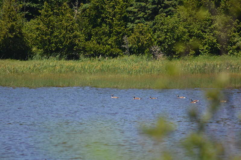
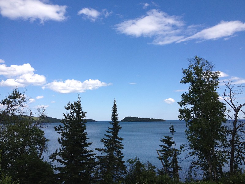
After a couple of small lake adventures, we were back to the shores of Lake Superior, this time on a boat that goes to Windigo at Isle Royale National Park. Although Windigo is reached by boat from Grand Portage, Minnesota, Isle Royale is part of Michigan. The island, Lake Superior’s largest, is known for long-term study of its isolated eastern timber wolf-moose populations and their predator-prey relationship. J. had seen a moose on his previous visit, but we weren’t going to have that kind of luck this day.
The boat was more crowded than I expected, with both day trippers like ourselves and overnight campers. Even in the sun, the air was much cooler than on our previous boat adventures, and I was glad I’d brought an extra layer along. J. was stuck with a single layer and short sleeves in the strong, chilly breeze.
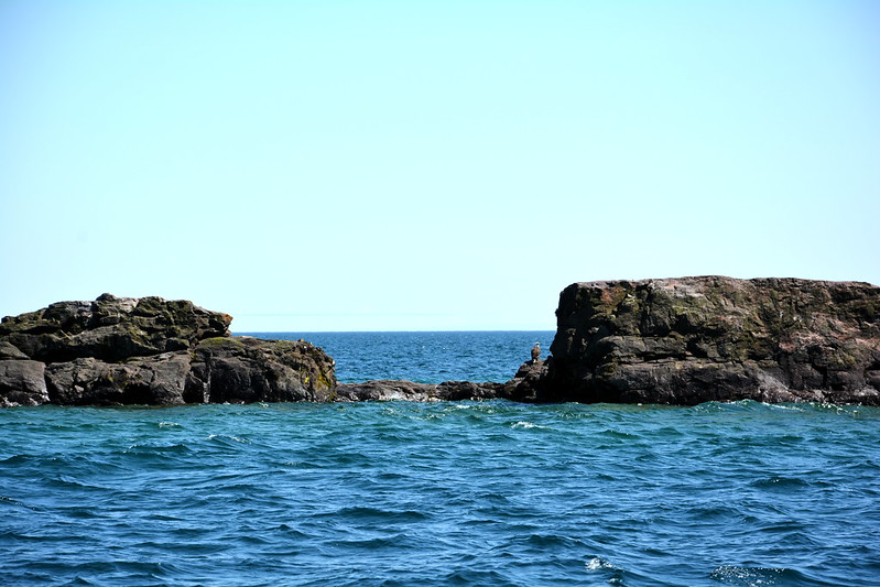
This is more of a ferry than a cruise, with the primary business of shuttling visitors back and forth between mainland and island park. The main intermediate stop on the outbound trip was to look at the wreck of the SS America, parts of which are visible in the shallow waters near Isle Royale. There’s nothing like the feeling you get when you’re looking at a sunken passenger ship from the deck of a passenger ship that you hope won’t end up next door. On the positive side, everyone aboard the America on June 7, 1928, made it to lifeboats.
At Windigo, we were greeted by National Park Service Interns, who helped give us the rundown on the rules. Once recent college graduate from lower Michigan told us how it’s a long adventure just to get home.
Once on Isle Royale, the first things I saw were a tiny northern red-bellied snake, one of the island’s three reptile species, and hundreds of butterflies swarming the bushes near the dock — both very easy to photograph. Given the limited amount of time we had, I spent too much time with the butterflies, at the visitor center, and in the convenience store.
Next, we took the nearby Nature Trail, which is close to the visitor center and passes through a few habitats before turning into a wide dirt road next to the water. We thought we saw a moose in the water across the way, but it was a combination of wishful thinking and a snag.
At the dock, we talked with an intern about the wolves. There are only an inbred handful left, a few adults and a few pups. They’re rarely seen, even by the rangers and interns. The island is home to other wildlife, including thieving foxes, which are featured on “Wanted” posters.
Recently I read that (inbreeding aside) one reason for the Isle Royale wolf population crash was parvovirus. Someone, ignorant of the rules or simply flouting them, brought their dog onto the island. I’m sure they thought, “Stupid rules. What harm can my Fluffy do?” As it turned out, Fluffy introduced a deadly disease to a vulnerable population. Bad dog (well, bad humans)! I’d like to think the culprit was caught, prosecuted, and punished, and also learned a lesson — but there are always those who believe rules (and laws) are for other people.
We talked to the intern so long that, before we knew it, the boat was full and about to set off. For much of the return trip, J. had to stand along the rail with a few others, with cold spray soaking all of them. The boat made only one stop that I can remember, at the magnificent Rock of Ages Light — another of my favorite trip photos.
Back on the mainland, we stopped at the Grand Portage National Monument, then continued to Grand Portage State Park, where an easy walk takes you to where the Pigeon River drops over High Falls, with Canada across the way. As with Cross River, the Pigeon seemed engorged compared to videos I’ve seen of it. We were covered with mist even before we reached the viewing platform, and I wondered how water resistant my new Nikon D7100 would prove to be.
With the Apostle Islands National Lakeshore cruise the next morning, we had a long drive to Bayfield ahead of us. We tried to get to Beaver Bay before Lemon Wolf Café closed for the night, but just missed it and ate at a nearby bar, then drove off into another long evening. We arrived at the Silvernail Guest House in the early morning hours, having left Minnesota behind reluctantly.